EN

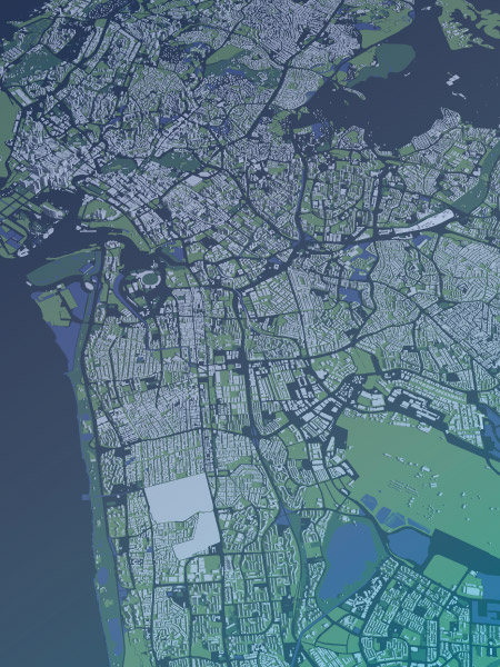
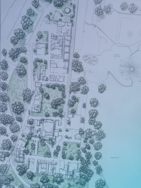
Zoning and environmental layout plans generated in a CAD environment are transferred to a central database, complete with geographic location and attribute data. All planning data—such as development conditions, land-use decisions, restricted areas, and plan annexes—are stored in GIS format. This data can be edited with CAD and GIS support and utilized for comprehensive queries and urban analyses.

CAD, GIS, raster, Excel, and other planning data are consolidated into a single geospatial data repository, making the corporate planning history queryable. The data can be utilized across desktop, web, and mobile applications, enabling time and cost savings by providing access to necessary planning decisions with a single command.
Planning data is enriched through topology and regulatory checks and stored in a central data source in compliance with standards, ensuring that planning decisions and calculations are managed without data loss. Implementation plans, master plans, and regional development plans—along with any amendments—can be queried from a single hub, enabling the generation of holistic planning data through inter-municipal integration. The entire lifecycle of a plan—spanning drafting, finalization, amendments, objections, and approvals—can be monitored and managed via a unified interface, incorporating restricted areas and supplementary documentation.

Data for which plan approval processes have been completed is transferred to a central data source and made accessible to citizens via KEOS E-İmar. Citizens can access plan information 24/7 through web and mobile applications. By enabling citizens to access zoning information online—without needing to visit the municipality—KEOS E-İmar moves information requests to a digital platform and reduces the workload of municipalities.

Authorities empowered to approve plans announce plans and plan amendments online during the public display period; the KEOS E-Zoning Public Display application manages this process digitally and in an integrated manner, ensuring that approved plans are published on the municipality's website with map support during the display period and automatically removed once that period ends. Consequently, citizens gain 24/7 online access to plans, the process becomes fully digitized, and the flow of information between the municipality and citizens becomes more transparent and efficient.
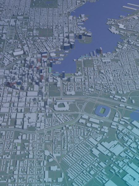
By converting 2D planning data—pertaining to urban plans, built-environment characteristics, and settlement conditions—into a 3D format, simulations can be generated using the Planet product or third-party software; this allows for the comprehensive visualization of planning parameters such as buildable area, floor height, and building footprint. By clearly demonstrating the potential impact of these plans on the urban landscape prior to implementation, this 3D urban simulation enables decision-makers to conduct more accurate assessments and gain a clearer understanding of the future urban form.

Value-Based Planning: In accordance with the regulation dated September 15, 2020, the preparation of real estate value change and market analysis reports is mandatory for zoning plan amendments to take effect. Accordingly, we analyze the planning area's current state and its projected state following the plan's implementation. Leveraging our integrated plan management systems, we generate reports on real estate value change analyses—based on geographic blocks/parcels or defined boundaries—and present them via web and mobile maps.
Data Services Integration: All planning decisions affecting the urban environment are integrated with external systems through a centralized data source. This unified data infrastructure enables rapid and effective, needs-oriented querying.


It can be easily converted to the Land Use Theme standards published via Decision No. 3 of the Türkiye Geographic Information System Executive Board, dated 20/08/2020.
Cadastral geometries provided via TKGM-TAKPAS services can be geometrically overlaid with planning decision geometries, enabling the matching of building blocks and blocks/parcels.
Plan data generated and stored in compliance with PlanGML data schemas is in a format that can be integrated with the e-Plan system.

Defining standards for data production is one of the initial steps toward ensuring controlled data generation and establishing a dynamic system that manages data from the point of creation through to its final presentation. You begin your work based on this approach, particularly when utilizing planning and engineering applications such as Netcad’s data entry tools.

Netcad solutions provide access to a wide range of data generation options—such as panoramic imaging, inventory compilation, and Drone/LiDAR data mapping—as well as various tools for processing and analyzing data from these sources. Netcad offers solutions that enable the management of generated data alongside other integrated systems and facilitate its transformation into high-value information.

Emerging technologies enable the execution of both planning and engineering processes and city management in a digital environment across all dimensions. With Netcad solutions, you gain the ability to not only generate and present your data in two and three dimensions—spanning everything from planning and engineering to city management—but also to present, analyze, and manage it in the fourth dimension.

Read, present, and utilize data in accordance with both the national TUCBS (Turkish National Geographic Information System) standards and national data-sharing standards.
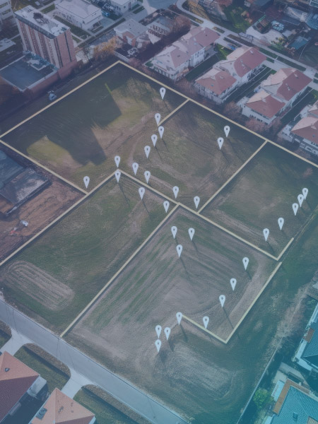
With over 30 years of experience, Netcad provides solutions for cadastre processes—a fundamental pillar of spatial operations—streamlining your workflows through online integration with Land Registry and Cadastre Information System (TAKBİS) web services across planning, engineering, and information system applications, and enabling you to execute all parceling-related tasks using processes and reports that comply with current regulations.

Carry out and report on expropriation procedures in full compliance with regulations. Centrally track and manage prepared expropriation plans at an organizational level. While performing the spatial analyses and reporting required for these processes, also utilize data portals provided by other institutions and e-Government services directly within the system.

We offer solutions that simplify your workflow—featuring editors, project templates, and processes that fully comply with regulations—while performing the fully automated and graphical distribution tasks essential to land consolidation. Utilize open data sources, e-Government services, and shared corporate data as resources throughout your processes.

We deliver solutions by integrating valuation expertise into our pioneering work in planning and engineering. Grounded in spatial analysis, we offer solutions for spatial implementations and policies—such as urban regeneration, the transfer of development rights, expropriation, and land consolidation—that are far fairer and more transparent, operating within the framework of the principle of equivalence. Furthermore, we provide reliable value maps by combining zoning and valuation data.
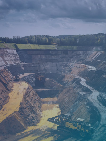
MABİS is a web-based mining information system solution developed for the digitization of mining law and textual data, as well as for the map-assisted tracking of all necessary permits and documents involved in the licensing processes for mining sites.

We enable you to rapidly and easily develop all your transportation projects—including highways, railways, airports, and interchanges. By facilitating efficient workflows, we boost your productivity and allow you to deliver optimal project designs in less time. We provide powerful tools and resources that enable better planning, reduced costs, and the ability to evaluate a wider range of project scenarios.

The cut and fill volume of a project is a critical component of the progress payment process. Netcad offers dynamic tools that enable you to generate excavation designs automatically and accurately. Save time, perform precise volume calculations, and boost your productivity. Confidently use the software for projects requiring complex excavation planning, such as tunnel portals, buildings, housing complexes, hospitals, treatment plants, dams, and flow regulators.

Many projects begin with a properly generated digital terrain model. Terrain models play a critical role in design, project management, and progress payment processes. Quickly generate your 3D digital terrain models from various data formats such as Point Cloud, ASCII, GPS, Raster, and LandXML. Automatically perform geometric analyses and 3D checks on models—whether generated in-house or sourced externally.

Effectively manage surface runoff and flooding in your projects; complete your drainage and hydrology tasks quickly and accurately. Automatically determine the locations and dimensions of drainage structures, design pipelines, and perform flow rate and pipe diameter calculations. Conduct flood analyses by modeling flow networks and watersheds that intersect road alignments, size flood protection facilities, and automatically generate hydrology and hydraulics reports.

With over 35 years of experience and deep industry expertise, Netcad offers solutions that enable you to rapidly create water infrastructure projects—particularly ponds, dams, and flood protection facilities. Build information systems to manage your projects and workflows without the need for coding. Digitize the management of your business and projects.

Drawing on over 35 years of experience and deep industry expertise, Netcad offers GIS-based solutions that enable you to rapidly create stormwater and wastewater projects. It allows you to migrate your projects to a digital platform and establish information systems for managing your workflows. Design and analyze your stormwater and wastewater projects in full detail, perform calculations, and build hydraulic models. Enhance your urban technical infrastructure.

Easily develop your drinking water projects across all stages. Conserve resources and reduce energy costs. Perform hydraulic and dynamic modeling. Leverage smart water technologies. Benefit from extensive capabilities designed to maximize efficiency and cost savings. Build information systems to manage your engineering projects and workflows. Digitize the management of your operations and projects.

Control surface runoff and floods. Easily perform flood discharge calculations and drainage projects. Automatically verify scenarios. Generate analyses. Automatically determine the locations and dimensions of your structures. Produce the hydrology and hydraulics reports required for your projects. Automatically size flood protection facilities, perform channel flow calculations, and generate hydraulic reports. Build information systems to manage your projects and workflows without the need for coding. Digitize the management of your business and projects.

By transforming data collected from sensors into intelligent insights, you can monitor water loss and leakage, sedimentation, water quality, and chlorine levels; generate alerts; and visualize and report data on a map. With our platform—supporting LoRA, Wi-Fi, NB-IoT, and GSM—you can create a digital twin of your water network, manage consumption, billing, and field operations using meter data, and detect anomalies via the data science module. You can carry out all these processes across web and mobile environments without the need for additional development.

With GASNET, you can define relationships and inventory data for natural gas network components, perform network analyses, and conduct map-based queries at either a regional or individual level. GASNET is an information system that facilitates the tracking of subscribers from the Subscriber Information System by displaying their actual locations on a map.
GASBOARD can dynamically visualize data regarding network components—such as pipe lengths, diameters, and valve types—in graphical formats, thereby playing a crucial role in making accurate and rapid investment decisions.
WEB GASNET saves time and costs by offering optimal solutions during malfunctions, leveraging the network-linked structure of service boxes, pipelines, and valves.
Smart Grid System
GASNET data screens are designed with all components interconnected. This enables easy access to detailed query screens and facilitates the preparation of periodic reports required for EMRA audits.
Subscriber Information Integration
Subscriber information system integration enables subscriber data to be grouped by residence and neighborhood, and allows for regional cost analyses to be conducted.

Network Analysis is a comprehensive Netcad solution that performs impact and accessibility analyses on electricity, water, and natural gas infrastructures. It analyzes flows in real-time using topology rules and network relationships, identifying elements that are inaccessible or cannot be supplied from the source. By rapidly pinpointing affected lines, structures, and subscribers during fault and maintenance processes, it ensures field teams are directed accurately. It detects faulty connections through topology checks, transfers CAD data to the database with a single click, and delivers accurate, rapid results via customizable analysis tools.