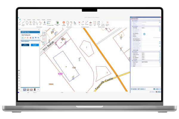
Netcad VGA is a powerful solution that securely transforms CAD data into GIS data under user authorization. It enables users to work dynamically on spatial databases, systematically updating both geometry and attribute information. VGA ensures that CAD data is transferred to the database according to predefined rules. During the transfer process, required attribute fields can be designed, and CAD object attributes can be automatically retrieved. Advanced relationships between datasets can also be defined, ensuring that each record transferred to the database is properly associated through attribute or geometry-based links. With support for regular expressions, SQL, and macros during data entry, VGA provides users with a fast, flexible, and intuitive interface to transfer and update data efficiently. The system allows for user-specific authorization, enabling only permitted users to update data based on their access rights, thereby preventing unauthorized modifications. Every action within the system is logged, including who performed the task and when, ensuring full traceability. With its advanced CAD & GIS data management capabilities, Netcad VGA offers flexible solutions for rule-based geospatial data production. These features make institutional data management processes more secure, reliable, and efficient.
Thank you, we have received your form. We will get back to you as soon as possible.
There are incorrect fields, please check and resubmit.
With VGA (Data Update Tool), a large number of plans and projects worked on in Netcad GIS can be transferred to the database together with their attribute information in addition to geometry information. Existing data in the database can be updated with VGA. It has four basic functions as Add, Edit, Delete, and Query.
Authorization Based Data Access
Users can log in to the application with the username & password defined by the system administrator. In the system, where individual authorizations can be made for each user, the permitted user can update the data on the basis of authorization and thus, prevent the unauthorized interventions.
Integrated System Architecture
VGA is fully compatible with other Netcad corporate products. Within the scope of the authorizations defined by the central system administrator, the user can extract data from the center and transmit the data to the center after completing the data update process. All these operations can be versioned.
Comprehensive Log Mechanism
All operations made with VGA are saved and the information of which user updates which data and when is comprehensively logged. Before & after status can be reported for all data changed through VGA.
VİDEOS
VGA Features
Informative videos about the features of the product.
New Interface
Numbering Management
F.A.Q.
Frequently Asked Questions About VGA
What is the main function of VGA?
Its primary function is to systematically transfer and update CAD data, along with geometric and attribute information, into spatial databases.
What types of data can it work with?
VGA works with CAD formats such as DWG/DXF and processes them by converting into spatial databases like PostgreSQL/PostGIS and Oracle Spatial.
How is attribute information managed?
Attribute information for objects to be transferred can be defined by the user. These details can also be automatically retrieved from CAD object properties.
How is data control and validation ensured?
During data transfer, rules can be defined to prevent incomplete or incorrect data entry, thereby maintaining data quality.
Can relationships be established between different datasets?
Yes. Both attribute-based and geometry-based relationships can be defined, ensuring consistency between objects.
Which databases does it integrate with?
VGA supports widely used spatial databases such as PostgreSQL/PostGIS and Oracle Spatial. Integration with external systems via web services is also possible.
Are process logs maintained?
Yes. The system records every action with details such as date, user, and operation type, ensuring full traceability.
What advanced features does VGA offer for expert users?
It provides advanced data processing and control options such as Regular Expressions (RegEx), SQL queries, and macro definitions.
Can real-time data transfer be performed while editing CAD objects?
Yes. VGA supports simultaneous transfer to the database while editing CAD objects.
Can bulk data updates be performed?
Yes. Multiple datasets can be updated simultaneously in bulk, saving significant time.
In which sectors can VGA be used?
VGA can be used across all sectors that require geospatial data, including urban planning, geomatics engineering, infrastructure management, public institutions, energy, environment, and water management.
Contact
Easily contact our sales representatives or technical support team