MABIS is a smart information system that enables the digital management of mining law, license, and permit processes. It eliminates the confusion caused by paper archives and scattered Excel files by gathering all documents in a secure and accessible digital platform. Thus, it strengthens the corporate memory of mining companies, prevents data loss, and ensures continuity in business processes.

Thanks to the automatic notification system within the application, you can receive reminders for due permit applications, payments, or critical files, and easily manage nearly 30 different task types. Its web and mobile-compatible structure allows personnel working in different cities to work in coordination with regular data flow. With its map-supported infrastructure, you can upload license, operation, EIA, GSM, and ownership boundaries into the system and carry out analysis and reporting processes in a single environment.

MABIS enables monitoring of personnel activities and tasks, performance measurement, and historical reporting. With its easy-to-use interface, integration capability, and reliable data management, it accelerates daily operations of enterprises, improves quality, and supports digital transformation in the mining sector.

Contact Us

Thank you, we have received your form. We will get back to you as soon as possible.
There are incorrect fields, please check and resubmit.

Key Features of MABIS

FEATURES

Key Features of MABIS

Find detailed specifications and descriptions on the technical specifications page.

Technical Specifications
Advanced Point Management
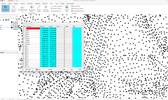
The software offers the ability to create, convert, and edit points using various methods. Users can easily manage points obtained through land surveys or manual inputs, improve their accuracy, and output them for effective use in their projects.
Conversion Options
Conversion processes can be easily performed using Affine, Helmert, and Projection conversions. The results can be printed to both a file and the screen.
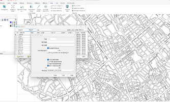
Automated Map Processing
MABIS offers automatic map sheet indexing and map sheet creation functionality in both local and national coordinate systems. Standard map sheets can be prepared using templates that conform to different institutional standards, and projects can be easily managed by dividing them into separate files.
Account in Compliance with Regulations
MABIS can perform triangulation and polygon calculations in accordance with the Large Scale Map and Map Information Production Regulation. It generates output reports containing tolerance values, automatically finds polygon routes, and enables calculations to be performed directly from the map.
F.A.Q.

Frequently Asked Questions about MABIS

On which devices can MABIS be used?
It is platform-independent; it can be used on computers, tablets, and smartphones. Mobile application support is also available for iOS and Android.
Can I view 3D models in MABIS?
3D models produced with Netcad’s mining solutions can be uploaded to the system and viewed online. Users can examine up-to-date models, view attribute information, and manage them.
Can personnel tasks be tracked through MABIS?
Personnel-based task assignments can be made, and task completion statuses can be monitored via a calendar. Authorization-based sharing within the team is supported.
Which queries can I perform through MABIS?
You can access and quickly query many types of information via computer, tablet, and phone, such as company information, site information, legal status, expropriation processes, and state royalty payments.
How is mapping done in MABIS?
Geometries such as license, operation, permit, forest, GSM, ownership, EIA, and quarry boundaries can be uploaded into the system in KML format. Additionally, coordinates can be exported in different projections, and online maps can be used as base layers.
How does the automatic notification system work?
MABIS sends automatic reminder emails for due permit applications, payments, or files that are difficult to track. Users can define tasks for critical items to secure the processes.
Which reports can MABIS generate?
Operational Activity Report, Site Summary Report, and General Reports can be generated automatically. With these reports, you can monitor the performance of processes and make reliable decisions.

Contact

Easily contact our sales representatives or technical support team

Sales

Reach our sales representatives quickly
bilgi@netcad.com

Technical Support

MABIS Support with 24/7 service approach
Netdesk

Call Us

Ankara Office
+90 312 265 05 10
İstanbul Office
+90 216 417 62 10

Visit

Visit our contact page for our Ankara and Istanbul Office locations
Contact

MABIS
E-Mail Subscription

Thank you! We have successfully registered your subscription.
Subscription could not be sent, please make sure you have entered a valid email address or do not forget to mark the required fields.