Netcad GIS is Turkey’s leading GIS software, developed for the creation, management, analysis, and sharing of geospatial data. With its advanced data processing capabilities, it is trusted across a wide range of industries—from engineering to urban planning, environmental management to mapping and infrastructure projects.

With its integrated CAD and GIS approach, Netcad GIS is designed to meet the diverse requirements of users from various sectors. It provides comprehensive support for tasks such as mapping, design, calculation, data conversion, reporting, and analysis, backed by extensive compatibility with different data formats. As a geospatial data platform, it supports a wide array of spatial information sources in line with international standards.

Equipped with advanced editing tools and industry-specific modules, Netcad GIS enables the creation of tailored projects for different professional fields. Its compliance with legal and regulatory standards makes it a reliable choice for both public institutions and the private sector.

Thanks to its flexible licensing model and large user community, Netcad GIS delivers effective solutions for projects of every scale. All profession-specific modules operate seamlessly on the Netcad GIS platform. With its innovative approach, it drives digital transformation, enhances user productivity, and contributes to the development of sustainable cities.

Contact Us

Thank you, we have received your form. We will get back to you as soon as possible.
There are incorrect fields, please check and resubmit.

Key Features of Netcad GIS

Customers Who Trust Netcad GIS
OVERVIEW

The convenience of CAD-based data production is integrated with the comprehensive rules of the GIS environment.

130.000+
Users
First Place for GIS Bilişim 500
80+
Universities
85%
Marketshare

For over 30 years, we've been creating solutions tailored to the needs of professionals across various disciplines. Our agile software development philosophy focuses on user needs and expectations, and we aim for continuous improvement.

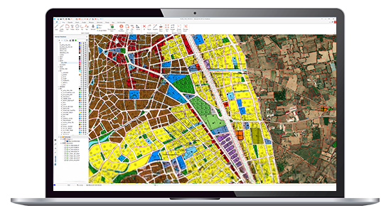
With Netcad GIS, we offer our users the freedom of a CAD environment and the advantages of a structured GIS environment. We believe these two spatial data formats complement each other in geographic data production processes, supporting them with dynamic CAD and GIS integration.

With its integrated CAD and GIS solutions approach, Netcad GIS is designed to meet a wide range of demands from different sectors and users. Rich data format support meets requirements such as mapping, design, calculation, data conversion, reporting, and analysis for many engineering and planning disciplines. Netcad GIS is a geographic data source that supports a wide range of spatial information sources at international standards.

With advanced data editing tools and module capabilities customized for different professional areas of expertise, it is possible to create projects tailored to specific needs. All modules developed to meet professional needs run on Netcad GIS.

FEATURES

Main features of the product

Browse the technical specifications page to review detailed features and descriptions.

Technical Specifications
CAD & GIS Supported Data Production
While designing your project with all the details offered by the CAD data format, you can simultaneously produce GIS data and convert to both geographic data formats.
Advanced Drawing Tools
Dynamically control the metric information of the drawing with angle, deviation, slope, automatic capture and object tracking capabilities.
Rich Format Support
A wide range of geographic data formats are supported such as DWG, DXF, DGN, GML, MAP/TIF, SHP, XYZ, NCN, GPX, OGC WFS, KML/KMZ, NMEA, TIF, IMG, DT0, DT1, DT2, PNG, JPG, GIF, HGT, HDR, ERS, GRD, DEM, ITIFF, PIX, NCD, ECW, SID, BMP, ICO, PCX, RAS.
Database Independence
Produce CAD objects from geographic data with Netcad GIS, which supports databases such as PostgreSQL, Oracle, Microsoft SQL, MySQL, SQLite, and Microsoft Access, which are highly popular worldwide.
Easy Data Conversion
Save your projects in different formats and easily produce CAD objects from spatial database records and web services.
OGC Web Maps Support
Access and query OGC certified WMS, WFS, WMTS, XYZ Tile services and use these services as a basis for your projects.
Extensive Library of Symbology
Simplifies your drawing stages with its advanced layer styles and line type library and ensures that you get accurate output.
Multiple Layer Support
CAD, GIS, raster data are sorted on the drawing screen in accordance with the "layer" logic, and relational data arrangements can be made.
VIDEOS

Netcad GIS Features

Informative promotional videos about the product's features

F.A.Q.

Frequently Asked Questions About Netcad GIS

In which industries can it be used?
Netcad GIS can be used across a wide range of industries including mapping, geology, construction, infrastructure, mining, and agriculture. With its modular structure, professionals can easily access and utilize the specific modules they need for their field of work.
Is database integration possible?
Yes. Netcad GIS is compatible with popular databases such as PostgreSQL, Oracle, SQL Server, SQLite, Microsoft Access, and Netcad Geospatial.
Can it work with online map services?
Yes. Netcad GIS supports a wide variety of online map services, including OGC-certified WMS, WFS, WMTS, WCS, CSW, as well as Bing Maps.
Does it support both 2D and 3D workflows?
Yes. Netcad GIS offers simultaneous 2D and 3D object editing capabilities. Elevation data and surfaces generated through sector-specific modules can be transferred into 3D environments, enabling comprehensive three-dimensional project visualization. With its 3D features, project outputs can be analyzed and visualized effectively.
Does Netcad have its own file format? Which data formats are supported?
Yes. Netcad’s proprietary file format is *.NCZ. It also works seamlessly with DWG, GML, DXF, DGN, NMEA, GPX, TXT, XYZ, NCN, XLS, LAS, LAZ, MDB, KMZ, KML, and SHP formats. Raster support includes TIF, LZW, ECW, GeoTIFF, JPEG, RAS, DEM, and many more. Additionally, Netcad GIS enables data generation from a wide range of raster elevation data sources such as DEM, DTEM, SRTM, and GDEM.

Contact

Easily contact our sales representatives or technical support team

Sales

Reach our sales representatives quickly
bilgi@netcad.com

Technical Support

Netcad GIS Support with 24/7 service approach
Netdesk

Call Us

Ankara Office
+90 312 265 05 10
İstanbul Office
+90 216 417 62 10

Visit

Visit our contact page for our Ankara and Istanbul Office locations
Contact

Netcad GIS
E-Mail Subscription

Thank you! We have successfully registered your subscription.
Subscription could not be sent, please make sure you have entered a valid email address or do not forget to mark the required fields.