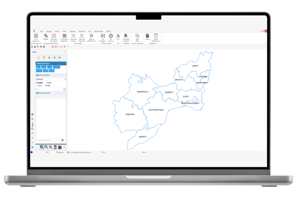
GISAra is an advanced desktop application that enables the querying and visualization of geospatial data, produced and managed by different departments, through a centralized platform. Supporting Geographic Information Systems (GIS) infrastructure, GISAra allows for the integrated management of spatial and attribute data.
This powerful tool works directly with map services, simplifying spatial analyses and enabling users to seamlessly visualize multiple data layers. By connecting to a centralized data source, users can view different layers and perform detailed queries. GISAra provides point, line, and area-based queries, as well as the ability to instantly display detailed attribute information for any selected location.
One of GISAra’s key strengths is its capability to manage spatial and non-spatial data together and generate reports in various formats. Users can quickly query data related to a specific location on the map and access associated resources such as photographs, scanned documents, and other supplementary files—ensuring a more comprehensive data management process.
By working in integration with map services, GISAra supports real-time data updates, ensuring users always have access to the most current information. Designed especially for public institutions, municipalities, and the private sector, this solution provides a fast and reliable GIS-based analysis environment, empowering more effective decision-making processes.
Thank you, we have received your form. We will get back to you as soon as possible.
There are incorrect fields, please check and resubmit.
With the block parcel search, the query results can be listed by searching the database for parcels and the desired parcel can be drawn on the screen. In addition, the opportunity to filter the query results is available.
Address Search
With the address search function, streets based on neighborhoods and the door numbers associated with these streets can be listed.
File Query
With the file layer (add-remove layouts), CAD and raster files in the system can be added to the screen for the desired region. There is also the option to add to the project for CAD files.
Database Layer
The spatial data included in the central data source can be drawn on the screen.
Location Based Query
It has the feature of combining various spatial information of a region on a single information screen. Quick reports can be obtained with this feature.
Integrated System Architecture
Gisara is fully compatible with other Netcad corporate products. Users query data within the scope of the authorizations defined by the central system administrator.
VIDEOS
GISARA Features
Informative videos about the features of the product.
General Introduction
F.A.Q.
GISAra Hakkında Sıkça Sorulanlar
What is the main function of GISAra?
GISAra provides access to query results with geographic location support through a single command by connecting to a centralized data source.
What types of data can GISAra work with?
GISAra can perform queries across different geospatial data sets and allows users to view data from multiple layers through a single interface.
How is archive management handled?
With GISAra, all archive data with a geographic reference can be added to projects with a single command.
How are query results displayed?
Query results can be displayed directly on the drawing screen, and CAD objects can also be generated from them.
What file types are supported?
GISAra can reference both raster and vector files, enabling users to work with various data formats.
What types of analyses can be performed with GISAra?
GISAra supports spatial queries and analyses, ensuring effective evaluation of geospatial data.
What types of data can be integrated with GISAra?
GISAra can manage both attribute and spatial data together, and provides access to supplementary resources such as photographs, scanned documents, and other files associated with data groups.
What types of maps can be viewed in GISAra?
With GISAra, base maps, zoning plans, and orthophotos can be quickly loaded and visualized.
In which sectors can GISAra be used?
GISAra can be utilized across all sectors that rely on geospatial data, including urban planning, geomatics engineering, infrastructure management, public institutions, energy, environment, and water management.
Contact
Easily contact our sales representatives or technical support team