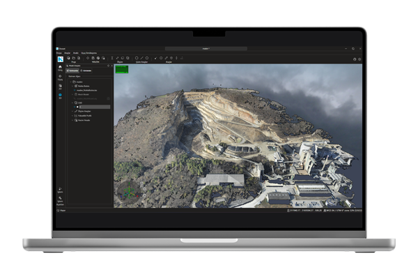
Photogrammetric Data Production
Photogrammetric data such as point clouds, orthophotos, digital terrain models, digital surface models, and mesh models with coordinates can be produced from raw aerial photographs captured by drones. These data can be effectively used in mapping, analysis, and engineering projects, providing high accuracy.
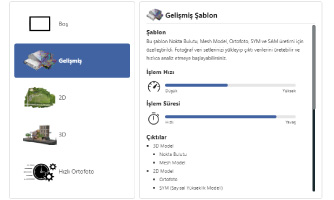
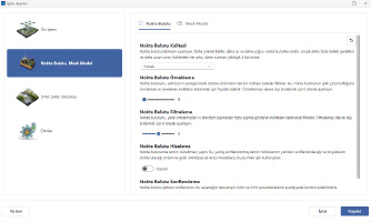
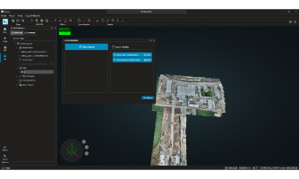
2D and 3D Project Templates
The data production process is initiated by selecting 2D or 3D project templates according to user requirements. With the 2D template, orthophotos and surface models are generated, while the 3D template allows the creation of detailed outputs such as point clouds and mesh models.
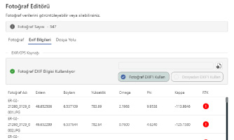
Photo and EXIF Management
EXIF information in the photos is automatically read and integrated into the system with X, Y, Z coordinates and orientation parameters. RTK-supported flight information can be viewed; positional accuracy can be further improved by loading data from an external file.
Advanced Processing Settings
Before starting 2D and 3D production, quality parameters can be defined. Steps such as preprocessing, terrain modeling, and mesh generation are optimized based on user-specific settings, ensuring fast and high-quality data production.
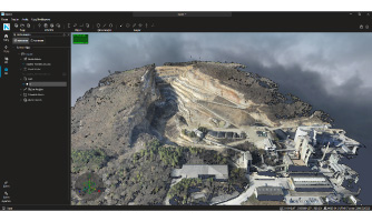
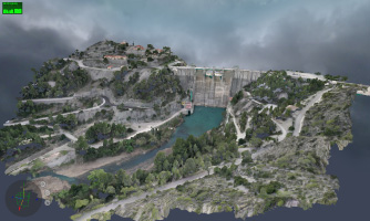
Point Cloud and Mesh Management
The produced point cloud and mesh data can be used in various analyses and exported in different formats (.las, .laz, .obj, .glb, .dxf). Unwanted objects can be removed from the mesh model to perform volume analyses aligned with the natural terrain structure.
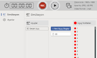
Flight Simulation and Video Production
Virtual flight videos can be created from mesh or point cloud data. With these simulations that provide a real flight experience, impressive and informative video content can be produced easily for exploration, presentations, and planning purposes.
CAD Integration and Layer Management
CAD drawings can be integrated into the project and edited. Operations such as defining intermediate elevations, adding vertices, and changing colors can be performed. Layers can be exported in .dxf format, enabling data exchange with different engineering software.
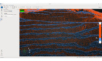
Analysis and Comparison Tools
Offers comprehensive analysis tools such as height profile extraction, volume calculation, raster comparison, and slope map creation. Changes occurring over time can be easily monitored, reported, and used as strong decision support in engineering projects.